FIRST ALERT: Showers return this weekend
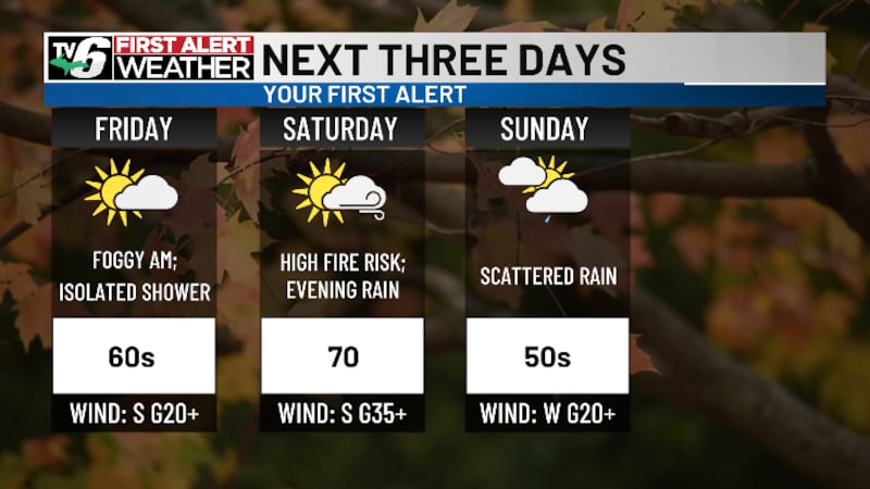
MARQUETTE, Mich. (WLUC) -Unseasonably warm conditions will continue into the weekend. Highs will range from ten to twenty degrees above the normal today.
Download the First Alert Weather App here
Winds become breezy tomorrow ahead of a front. Gusts will range from 25- 35 mph out of the south during the day. Spotty rain is possible tomorrow morning. Otherwise, scattered showers develop tomorrow night through Sunday.
Another system comes next Wednesday through Thursday. As of now, a few showers develop Tuesday evening. Then, a couple rounds of showers occur Wednesday, with light lake effect rain continuing Thursday morning.
Today: Morning fog, afternoon sunshine
>Highs: Upper 60s to low 70s west, upper 60s central, low 60s east
Saturday: Mostly cloudy and breezy
>Highs: Upper 60s to low 70s west, upper 60s central, low 60s east
Sunday: Mostly cloudy with scattered light rain showers
>Highs: Low 50s at shores, mid to upper 50s inland
Monday: Mostly cloudy and cooler
>Highs: Low 40s north, upper 40s south
Tuesday: Mostly cloudy with evening showers
>Highs: Low 40s west, mid 40s east
Wednesday: Cloudy with scattered showers
>Highs: Low 50s at shores, mid 50s inland
Thursday: Lake effect rain showers north
>Highs: Low 50s west, mid 50s east
The video above will feature the TV6 livestream until staff can clip the corresponding story, if available, from broadcasts or other TV6 content. You can subscribe to our YouTube page or download TV6+ to stream the latest local news and weather.
Copyright 2026 WLUC. All rights reserved.